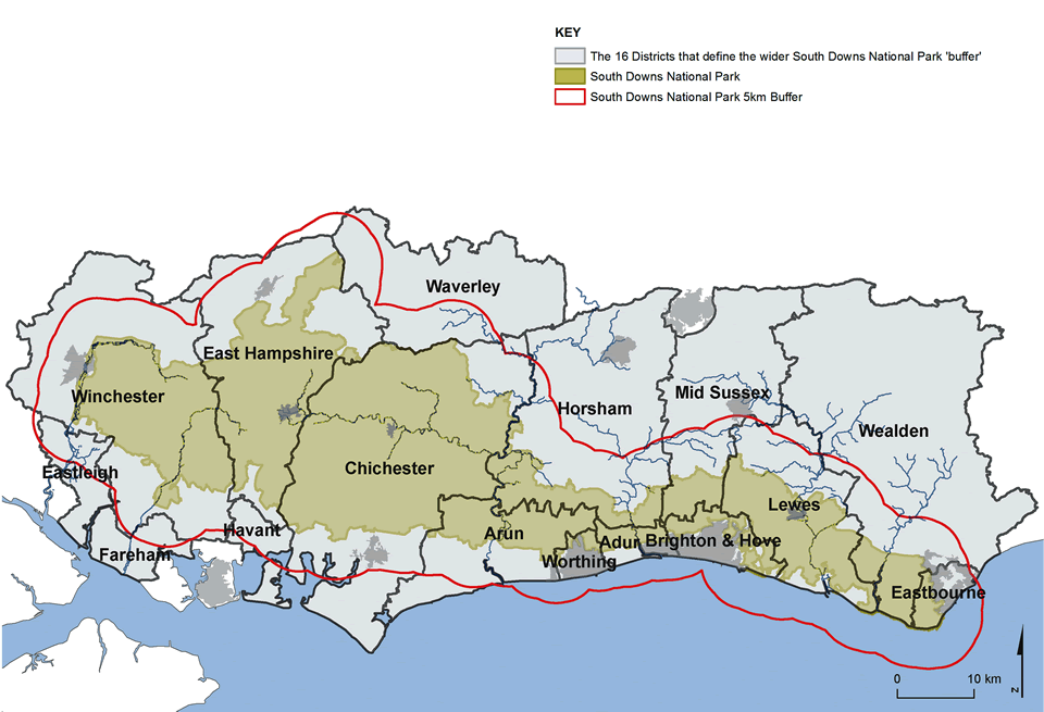
Map 5.1
Illustrates the 5km buffer zone around the National Park which takes in 16 district and unitary authority areas
Maps prepared by: GeoSpec, University of Brighton; February 2012.
Source: South Downs Local Economy Report, Hampshire County Council, 2011
Ordnance Survey Crown Copyright © Licence No. 100050083.